Volunteers biked from September 28 till October 21 2016 on different streets in Kampenhout. The measurement track contains busy roads and calm, rural streets. The route also passes by a number of schools. The measurement track has a total length of around 22 km and consists of two loops on which simultaneous measurements are conducted by two volunteers. The first loop (12 km) starts on the Langestraat and ends in the neighborhood of the town hall. The second loop starts and ends in the proximity of the town hall. The measurement track is done by bicycle at a low speed (± 10 km/h) and is cycled clockwise.
Measurements have been collected on working days at 8h15 – 9h15 and at 17h00 – 18h00 to map the air quality during the rush hours. The track has been repeated 25 times, 14 times during the morning and 11 times during the evening rush hour. Repeated measurements are required to obtain a representative result.
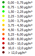
The airQmap below shows a map of the average BC (Black Carbon) concentrations in Kampenhout during the morning and evening peak. For each 20 meter road segment, the average concentration is given in ng/m3. The lowest concentrations are shown in green. Information about the used color scale is available on the INFO page.
You can see this map in 3D on Google Earth. You can download the KML file for Kampenhout.